
Through the use of social mapping techniques, the research work of the New Social Cartography of the Amazon Project (PNCSA) seeks to analyze the differentiated processes of territorialization which are currently underway in the Amazon region. In doing so, the work focuses on the relationship between these processes and the emergence of collective identities embedded […]
A View from Above

Lebanon currently houses 53 percent of a total of approximately 450,000 registered Palestinian refugees (UNRWA, 2016). Bourj Al Shamali is located three kilometers east of Tyre in the south of Lebanon; approximately 22,000 registered refugees live here. From the original 7,000 refugees who fled or were expelled from their homes in 1948, the majority of […]
Militarization of Rio de Janeiro’s Favelas
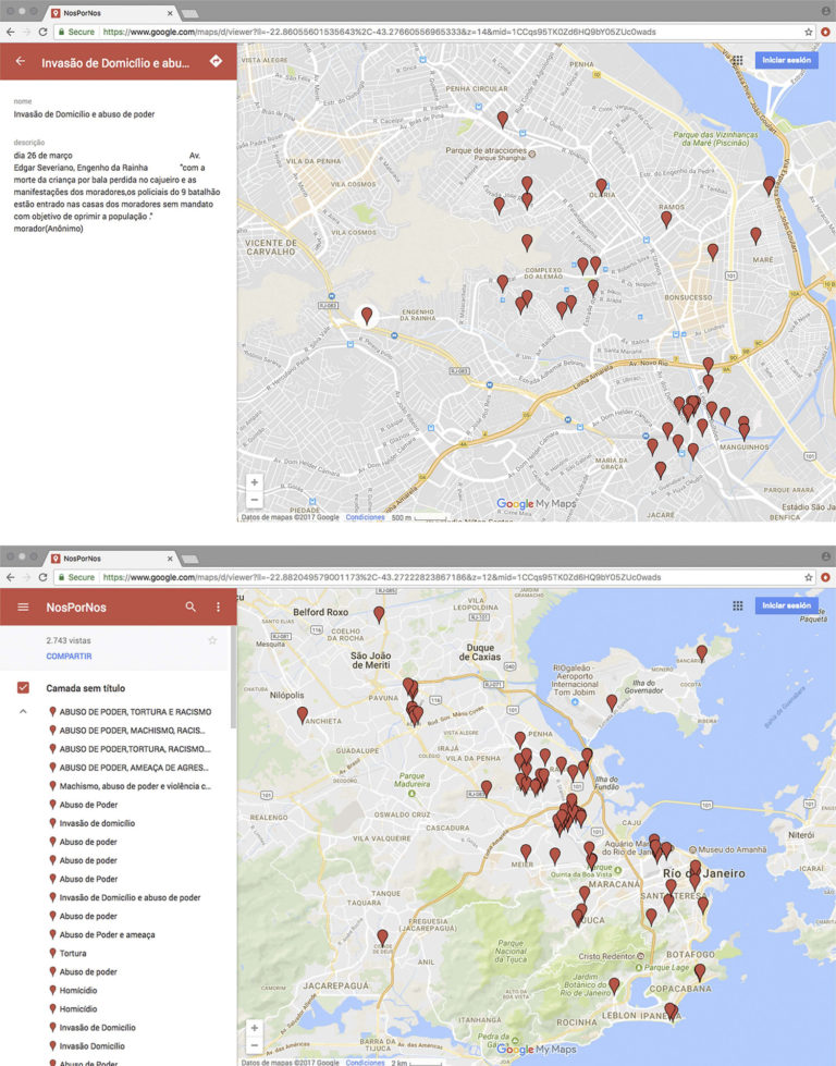
A young woman, identified only as Carolina, was going to school when the police raided her house. Grassroots communicators were violently prevented from doing their work and recording police operations in the favelas occupied by the Pacifying Police Unit (UPP) in Rio de Janeiro, which is a sign of the criminalization of social movements and […]
Mapping Safe Passages
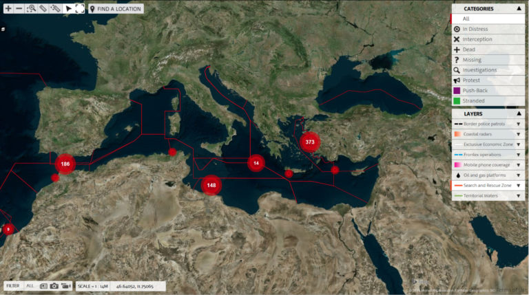
During the long summer of migration in 2015, the importance of digital tools for transnational movements of people has been widely acknowledged. While states have been using geographical information and maps to control movements of people across space for a long time, transnational migrants and support network have found creative ways of using online mapping […]
Mapping the Anti-Eviction Struggle in the San Francisco Bay Area
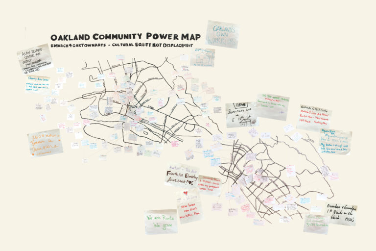
The Anti-Eviction Mapping Project (AEMP) is a data visualization, data analysis and storytelling collective documenting the con- tours of gentrification in and beyond the San Francisco Bay Area. The project emerged in 2013, focusing on connections between San Francisco real estate speculation and forced displacement, but has since grown in both its geographic scope and […]


