
The Knitted Flood Wall, 2012, was a socially engaged participatory art project initiated by Irish Visual Artist Martina O’Brien in collaboration with The Ballsbridge Dodder Residents Association, Dublin. It was founded in the aftermath of the flooding of the River Dodder, Dublin, Ireland, 24 October 2011. The project witnessed the creation of a 45 feet […]
A Students’ Map for a Students’ Building

We are Geoide en Revolución, a political group composed of students and alumni of the Faculty of Geography at the University of Buenos Aires. At some point in our activism, a few years ago, we began to understand and use social cartography (similar to participatory mapping) as a valuable tool for working with and for […]
Untangling the Strategies of Capital

Ecuador’s Critical Geography Collective emerged in 2012 as a result of a happy encounter among geographers, social scientists and activists concerned with answering theoretical and practical questions about growing territorial tensions around the country. Even though Ecuador has had one of the most advanced constitutions in the world since 2008 pertaining to the rights of […]
A Civic Mapping Project in an Indian Megacity

Hyderabad Urban Lab (HUL) looks at cities as a complex set of relationships consisting of relations of production, social relations and relations between citizens and governments. HUL began in mid-2012 with the aim of conducting research on urban issues in a way that would bridge the gap between academic urban research and life at the […]
Indigenous Cartography in Acre
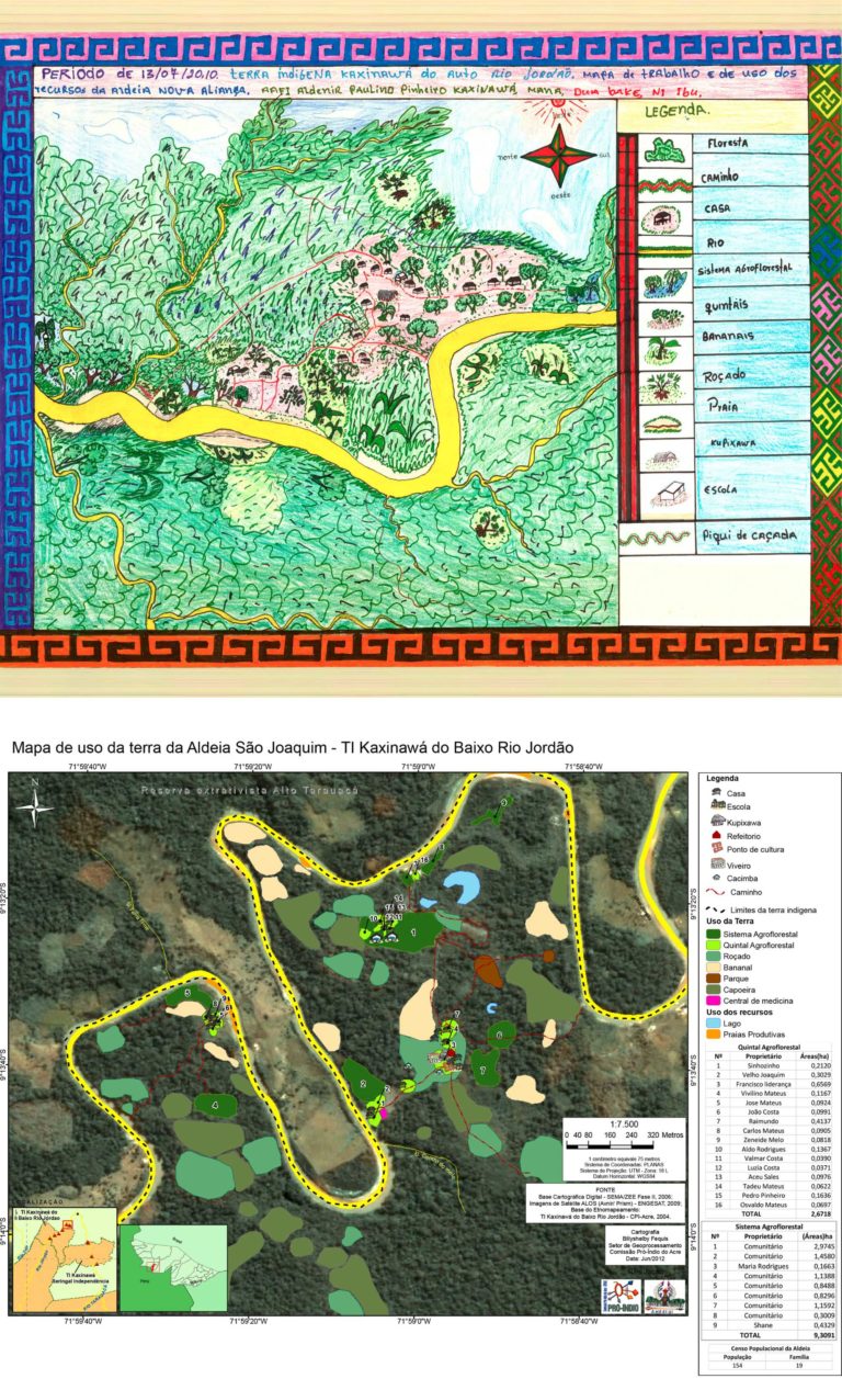
“The map is the mirror of our community, it serves to show what we learn and helps in understanding the territory.” IAAFs Raimundo Kaxinawá, 20081 The experience reported here refers to the Pro-Indian Commission of Acre (CPI / AC), which has been working to produce “Indigenous Cartography” with Indigenous Agroforestry Agents (IAAFs) as a means […]


