
Mapping is a deeply political practice. Especially when considering how it is embedded in the reproduction of power in the Philippine context. Historically, mapping can be linked to colonial exploits and imperial pursuits as it attempts to represent colonized populations and places within a legible territory conducive for exploitation and control (see Harris & Hazen, […]
Emancipatory Mapmaking: Lessons from Kibera

Modern mapmaking in the global South has been deeply entwined with the colonial endeavor of producing legible spaces. Critical Geography has emphasized the role of maps in governing populations and their politics of in/visibility, especially concerning marginalized communities. What else can maps do? How can communities and activists deploy mapping technologies as tools that support […]
A New Social Cartography

Through the use of social mapping techniques, the research work of the New Social Cartography of the Amazon Project (PNCSA) seeks to analyze the differentiated processes of territorialization which are currently underway in the Amazon region. In doing so, the work focuses on the relationship between these processes and the emergence of collective identities embedded […]
Collaborative Cartography in Defense of the Commons

GeoComunes is a collective that carries out research and collaborative mapping for the defense of common goods. We understand common goods as all elements that are integrated within the process of social reproduction and which by that form the very fabric of freedom and any possible life in the community. Our cartographic perspective includes two […]
The Environmental Justice Atlas
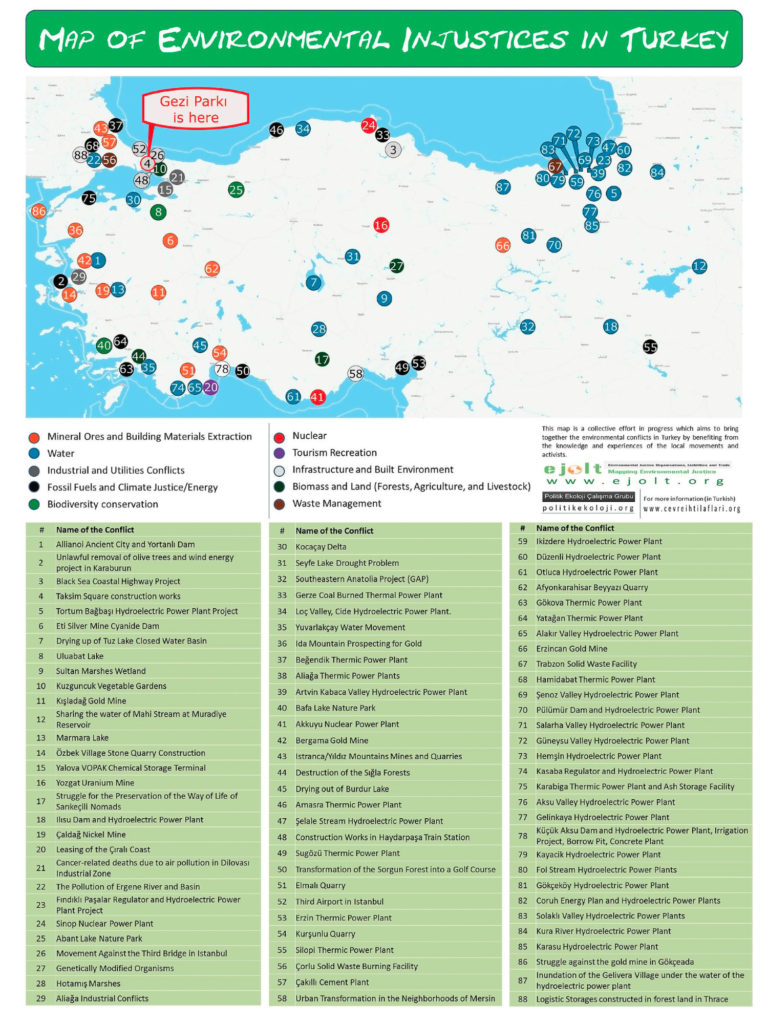
The environmental movement has been described as “the most comprehensive and influential movement of our time” (Castells, 1997: 67), representing for the “post-industrial” age what the workers’ movement was for the industrial period. While strike statistics have been collected for many countries since the late nineteenth century and are currently tracked by the World Labour […]


